Scope of Work:
GPR survey execution for mapping underground utilities to ensure safety of pre-existing assets during pile construction.
Location:
Ahmedabad, Gujarat, India.
Client:
Ranjit Buildcon Limited.
Equipment:
GSSI SIR-3000 equipped with 100 MHz, 200 MHz and 400 MHz antenna
Challenges:
uneven accessibility to the area to be surveyed
Summary:
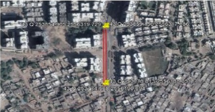
The GPR survey has been carried out at proposed metro route near Motera station, Ahmed-
abad. The total area scanned was approximately 3200m2 on a road. The scope of work
includes the mapping of possible underground utilities up to the depth of around 8 m using
non-destructive Ground Penetrating Radar technology. The purpose of the project was to
map all the underground utilities and to attain a clear underground space to install the piers
for the proposed metro route. However, the main focal point of the survey was to map the
alignment of deeper sewer drain in order to better plan the construction work of the metro
route as well as preventing the damage to the existing sewer drain. Considering the client's
requirements and the expected depth of the utilities, the area has been surveyed using three
different center frequency antennas i.e. 100 MHz, 200 MHz and 400 MHz mounted with SIR
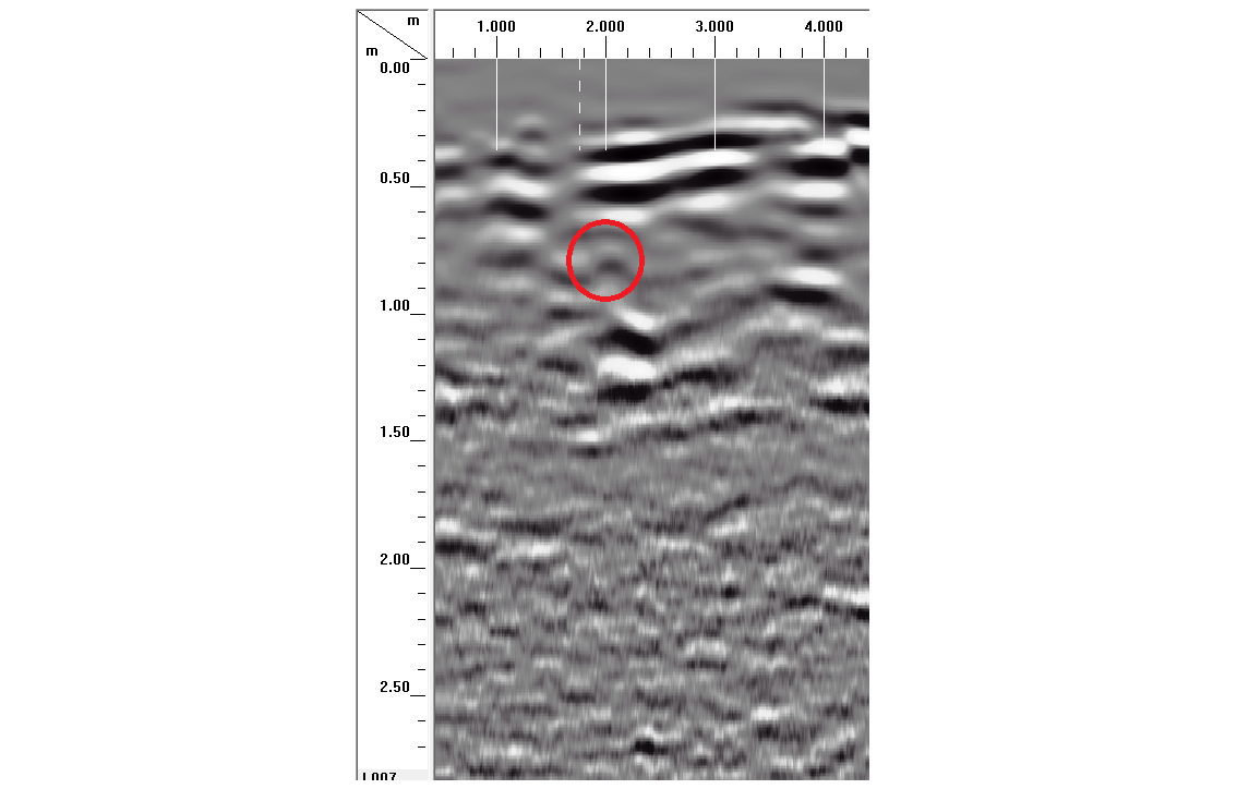
3000 GPR system to cover the depth up to 8 m with the fair resolution. The purpose of the survey was to map all the
underground utilities viz. cables, water lines, gas lines, sewer line etc. up to the depth of 8 m
using non-destructive technology. The whole data is collected depending on the site condition
and maximum accessibility of the road. Numerous parallel profiles have been collected across
the width of the road at a spacing of 3 m. Overall 12 utilities are found to exist at different depth range. The alignment of observed utilities agreed with the information available from client's
end. No other utility is found to be exist at this greater depth than 5.3 m.