Scope of Work:
GPR survey execution for mapping underground utilities to design the underpass preventing the damage to the pre-existing assets.
Location:
Ahmedabad, Gujarat, India.
Equipment:
GSSI SIR-3000 equipped with 200 MHz and 400 MHz antenna
Summary:
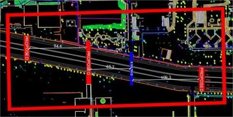
The GPR survey has been carried out at three locations of proposed underpasses under 132
Feet Ring Road as connection between new and old IIM campus for IIM Ahmedabad. The
total area scanned is around 1500 m2 in 9 patches on road and 12 patches on service road and
footpaths. The scope of work includes the mapping of all possible underground utilities upto
the depth of around 6-7 m using non-destructive Ground Penetrating Radar technology. The
purpose of the project is to plan the execution of proposed underpasses project and prevent
the damage to the existing utilities during the construction phase of same. The purpose of
the survey was to map all the underground utilities viz. cables, water lines, gas lines, sewer line
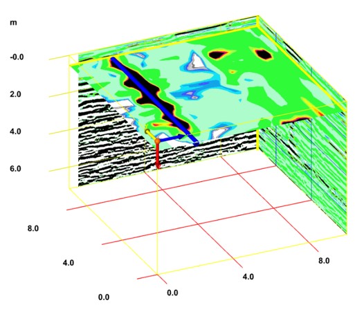
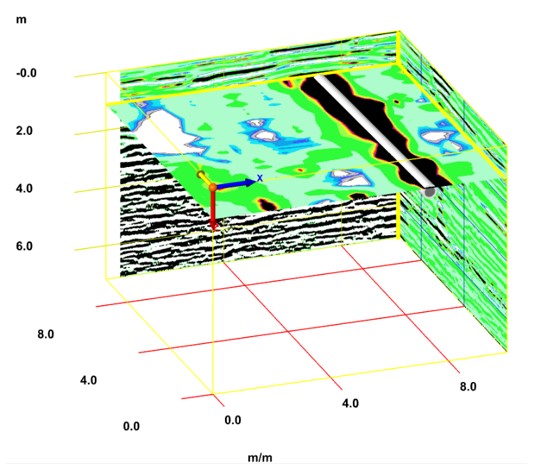
etc. upto the depth of 5-6 m using non-destructive technology. The whole data is collected in
nine patches, each of dimension approximately 10 m X 11 m. Numerous parallel profiles have
been collected across the width as well as along the length at an spacing of 1 m. Over all around 16 utility service lines along the road could be interpreted on the basis
of repeating impressions in various profiles of patches.
Interpreted utilities are categorised in different quality levels as per ASCE-3802 to define
the tentative confidence level.