Scope of Work:
GPR survey execution for mapping underground utilities to ensure 30 m wide clear stretch for smooth installation of new pipeline in Dahej
Location:
Dahej, Gujarat, India.
Client:
Corrtech Energy Ltd.
Equipment:
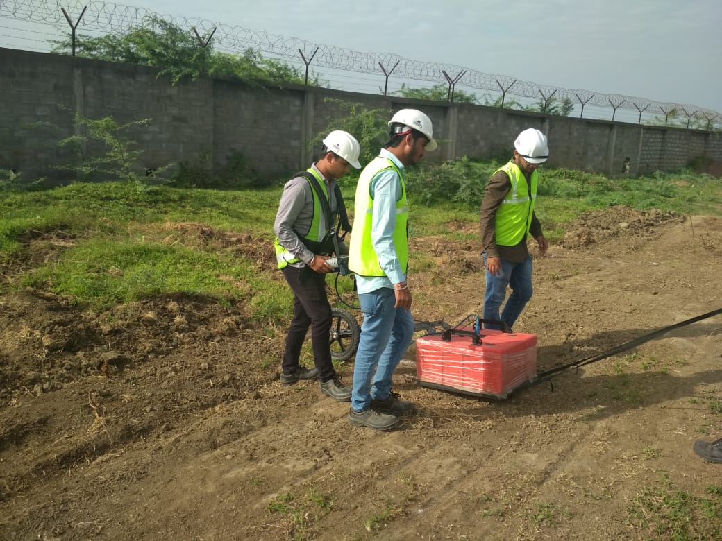
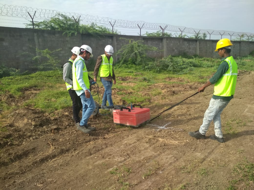
GSSI SIR-3000 equipped with 200 MHz and 400 MHz antenna
Challenges:
Undulated land for data collection, industrial area having chemical contaminated medium, weak signal GPR data, high moisture content
Summary:
Ground Penetrating radar survey was executed at proposed alignment of new pipeline installation in and around OPAL in Dahej SEZ area. Dahej being industrial area contains huge network of underground utilities. The lack of information of these buried utilities leads to damage of same during installation of new pipeline through HDD or other methods.
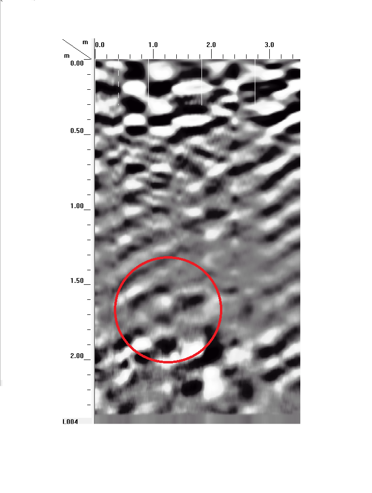
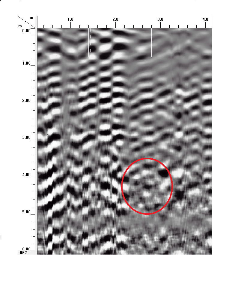
Hence, a GPR survey was executed to map all the pre-existing underground utilities upto the depth of 10 m to plan the hassel free installation and prevent any kind of damage.
As the area was ungraded which makes the collection of the data laborious and their interpretation have been a challenging job.
However, based on the processed data and the subsidiary information, the best possible attempt has been taken to interpret the outputs with the utmost accuracy. GeoCarte could successfully locate deeper utilities as deep as 3.6 m. The sectional view at every 6 m was generated based on client requirement for improving the accuracy in planning of exact route of new pipeline.
The GPR report helped the client to design new layout of the pipeline and plan the smooth project execution.